
Architecture
The redevelopment of Freemans Bay’s Phillip’s Block (as Freemans Park was previously known) constitutes one of Auckland’s most ambitious mid-twentieth-century housing experiments, defined by evolving architectural strategies that balance density, landscape, and typological diversity.
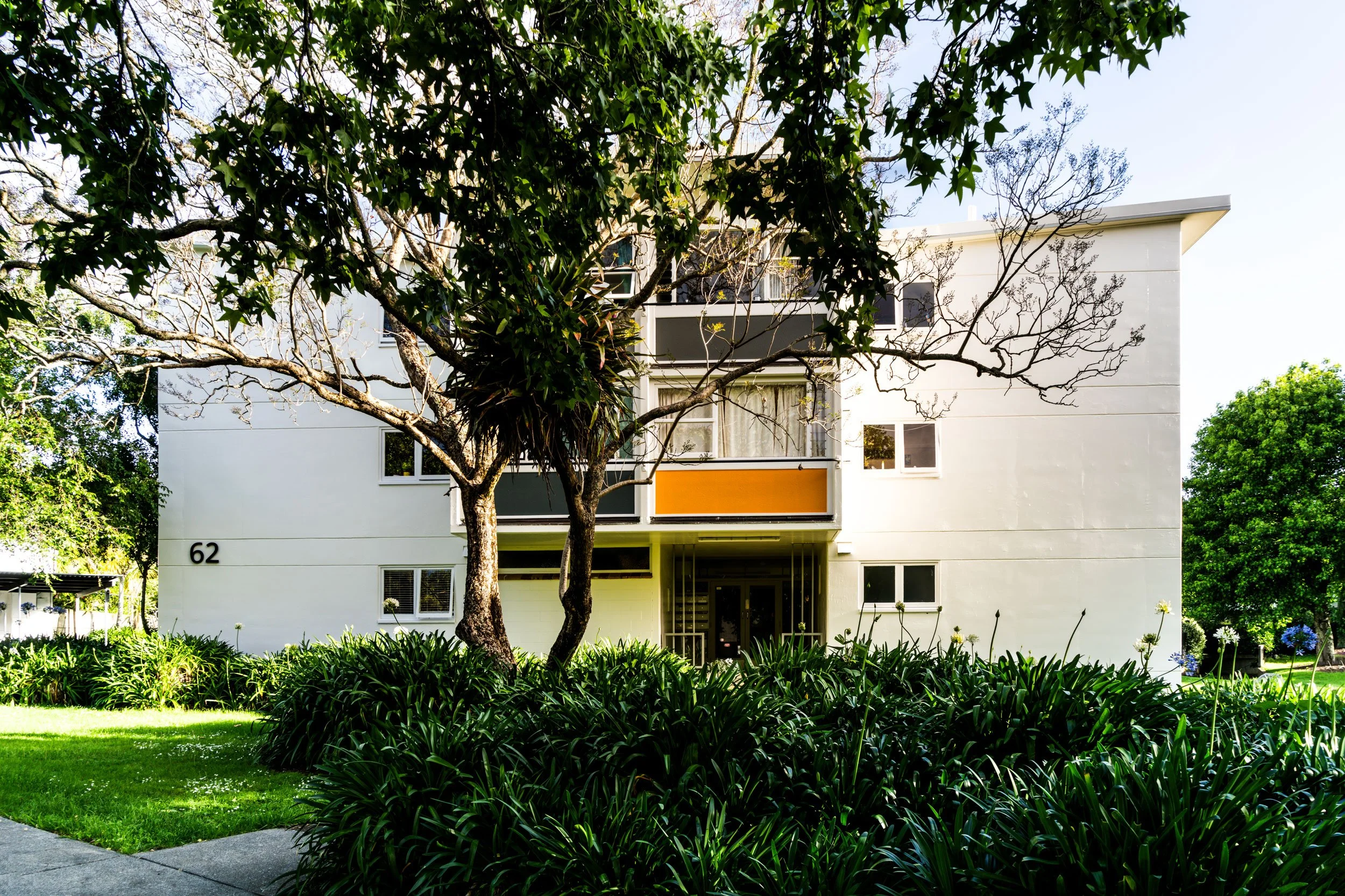
The star blocks expressed a more austere and repetitive modernist language: Rectilinear massing, planar façades, and a consistent structural grid that prioritised efficiency and economy over formal variation.
The 1955 proposal for the site – bounded by Beresford, Howe, Wellington, and Hepburn Streets – advanced a carefully composed “mixed development” that responded directly to the steep gully terrain and existing urban grid. Rather than imposing a singular monumental form, the design deployed a range of housing types to articulate scale and spatial hierarchy across the site.
The scheme combined two-storey terrace row houses, long rows of three-storey maisonettes, and a 322-foot multi-storey slab block containing predominantly two-level maisonettes. The terrace houses, positioned prominently along street edges, mediated between the redevelopment and the surrounding neighbourhood fabric. The three-storey maisonette rows were designed with curved shell-concrete roofs, introducing sculptural variation and a distinctive modernist profile. The principal slab block, served by lifts stopping on alternate floors to access two-storey maisonette units, reflected contemporary European planning ideas that sought to combine vertical circulation efficiency with the spatial qualities of duplex living. Across the scheme, unit types ranged from bed-sitting rooms to four-bedroom flats, reinforcing the architectural ambition to accommodate varied household structures within a unified composition.
Crucially, the 1955 design avoided rigid symmetry. Buildings were arranged to frame communal greens of varying sizes, creating a sequence of semi-enclosed open spaces. Pedestrian paths linked these greens, separating foot traffic from vehicles and embedding circulation within landscaped grounds. Architecture and landscape were conceived as interdependent systems: Built form defined the edges of open space, while planting and recreation areas softened and animated the modernist geometry. The intention was to prevent the monotony associated with large-scale housing projects by modulating height, roofline, and massing across the development.
However, in 1959 the original plan was abandoned, largely due to financial constraints, and replaced with a more standardised approach centred on the government-designed “star block,” developed under Government Architect Gordon Wilson. Between 1960 and 1967, nine star blocks were constructed on the site. These were freestanding slab buildings, oriented broadly to the cardinal directions and set within open grounds created by filling the former gully with demolition material. Architecturally, the star blocks expressed a more austere and repetitive modernist language: Rectilinear massing, planar façades, and a consistent structural grid that prioritised efficiency and economy over formal variation.
Importantly, the post-1959 redevelopment did not consist solely of slab blocks. Maisonettes and courtyard or row houses, designed by the Auckland City Architects Department, were incorporated into the overall scheme to broaden the housing mix. This retained, in modified form, the earlier commitment to typological diversity, even as the dominant visual character became defined by the repeated slab form. The integration of these lower-scale elements introduced transitional edges and helped mitigate the monumental scale of the star blocks within the open landscape.
Landscape remained central to the architectural concept. Buildings were conceived as objects within a continuous green field, with tree planting and open-space planning reinforcing the park-like setting. The final built outcome thus represents a hybrid condition: A shift from the sculpturally varied, site-responsive composition of 1955 to a more standardised modernist ensemble, yet still incorporating maisonettes and row housing within a comprehensive high-density residential landscape.
Source: Bradbury McKegg Ltd and John P Adam, Freemans Park Landscape Evaluation.